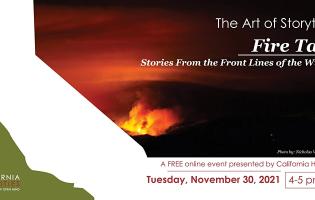
Lake Oroville
Lake Oroville Relicensing Project
Over the spring, summer, and fall of 2002, teams of archaeologists from ASC, Sacramento State University, and the local tribal communities at Mooretown, Berry Creek, and Enterprise worked in the more than 40,000 acres surrounding Lake Oroville.
The work was conducted for the California Department of Water Resources
(DWR).
The ASC oversaw the fieldwork, and ASC archaeologists were responsible
for the recording of historical sites identified during the survey. This
work was part of the relicensing of Oroville Dam, and was performed to
get an idea of how many archaeological sites there are on the property,
which ones are important, and whether they will be affected by the operation
of the dam.
The fieldwork continued for 135 working days, with the survey teams
covering about 42 percent of the total above-water acreage. The total
area surveyed was about 12,796 acres, or almost 20 square miles of land
that were walked over and intensely examined. Within this area, the teams
located 692 archaeological sites. These were made up of 240 prehistoric
sites, 384 historical sites, and 68 sites with both prehistoric and historical
occupations.
Any archaeological work needs careful planning, but at Oroville the sheer
size of the area added an extra level of complexity. Since surveying all
the land was not possible, the archaeologists designed a three-staged
approach to the survey effort. The first stage was a survey of a 30 percent
sample of the project area, covering different environmental zones. The
second stage was as complete a survey as possible of the draw-down, or
fluctuation, zone of the lake. This zone has been heavily affected by
the lake, so assessing the impacts on sites was particularly important.
A complete survey was possible in most of the fluctuation area because
nearly all the vegetation had been stripped away as a part of construction,
in contrast to many other parts of the project area that were still densely
vegetated. Because safety was a major concern on the survey, teams did
not survey areas in the fluctuation zone where the terrain was too steep
to be safe. The third stage was focused on locations that likely once
had historical sites, as identified during the historical research, especially
locations for which homestead claims and proofs had been filed. The teams
also re-identified the known archaeological sites and surveyed areas that
are slated for construction or other ground-disturbing activities. Some
of the sites had not been seen for four or more decades, and all required
substantial re-recording.
In addition to the fieldwork, Jo Markwyn prepared a comprehensive historical
overview of the project area to provide context for the historical sites.
Elaine-Maryse Solari completed a preliminary oral history program, identifying
long-term residents of the area, and conducting interviews with selected
people.
After the fieldwork was completed, the next stage was analyzing the data
and incorporating the findings into a draft report for the DWR.
Two key
elements in this were preparing site records and GIS layers. Creating
site records in a timely manner for the Northeast Information Center was
a massive effort, requiring a dedicated team and the introduction and
mastery of new software. The skills and innovative approaches developed
during the Oroville site record production will be invaluable in future
report and site record production at the ASC. The creation of a GIS for
the nearly 700 sites identified over 40,000 acres greatly eased analysis
of these data for the report, and is an important product for the DWR
in their management of these properties.
Results of the Lake Oroville Inventory
Gold mining has been an important part of the economy along the Feather River from the Gold Rush well into the 20th century, an importance that is reflected in the archaeological record. The different kinds of mining operations left traces and often outright scars on the landscape. The evidence for placer-mining operations ranges from small waste-rock piles in streambeds to acres of sluice banks and gullies from hydraulicking and ground sluicing. In several areas the entire landscape had been worked and reworked. More than 17 miles of ditches were recorded, showing the importance of water supply to the mining operations, and illustrating something of the grand scale of the operations.
In 1898 a new form of mining in California was used successfully for the
first time on the Feather River. This was dredging, which left vast fields
of cobble tailings that still dominate the landscape along the Feather
south of Oroville. About 8,000 acres (12.5 square miles) of the project
area in the Oroville Wildlife refuge is dredge field. This dredge field
provided much of the material used to construct the Oroville Dam.
In addition to placer mining, there was hard-rock or quartz mining, where
shafts were actually driven into the gold-bearing quartz veins.
The survey located several mining tunnels (or adits), ore-cart tracks,
and what may have been foundations for processing facilities.
Although mining tends to dominate the written history of the area, after
the 1850s most people were working in other enterprises, especially logging,
farming and ranching, and commercial businesses. Many farmers and ranchers
mined on the side, moving in and out of activities as the economic conditions
and personal whim dictated. Some other industrial traces on the Lake Oroville
landscape were kilns and quarries from the lime industry, and remnants
of narrow-gauge railroads from historical logging. Although agriculture,
especially citrus orchards, was important to the area’s economy, it is
less archaeologically visible than mining. Most of the sites related to
agriculture took the form of farm buildings, pens, landscaping, and certain
kinds of vegetation. Some of the ditches and dams that the archaeologists
recorded may have been used for irrigation instead of, or in addition
to, mining. Most of the agricultural sites were found in the flatlands,
in the western portion of the project area.
The remains of entire communities, with homes, stores, and public buildings,
were inundated by Lake Oroville, and most of these sites are permanently
lost to archaeologists. Instead the archaeological survey found the remains
of more dispersed residence. Associated with the mining, agricultural,
and industrial sites were the remains of people’s homes—from the temporary
camps of miners and railroad and construction workers, to farmsteads,
a few of which were occupied for decades. About one-quarter (117) of the
historic-period archaeological sites contained residential remains, such
as house foundations, tent pads, and artifact scatters.
The next stage of the Lake Oroville archaeological project will be gathering
information from selected sites to determine how significant they are
and whether they are eligible for listing in the National Register of
Historic Places—the nation’s inventory of significant archaeological sites,
historic buildings, and various structures and objects. Also planned for
the next stage is inventorying and evaluating standing buildings and structures
within the property. Thus the archaeological inventory and historical
research at Lake Oroville completed so far represent only the beginning
of a larger effort that will enable the DWR to manage the cultural resources
around Lake Oroville effectively.
Oroville Dam Historical Research
The
ASC is responsible for coordinating the historical significance evaluation
of the Oroville Dam and its related facilities that were erected between
1961 and 1968 in Butte County as part of the California State Water Project
that was initiated in the mid-1950s. At 770 feet high, the Oroville Dam
is the highest earthfill dam in the United States and crucial element
in the State Water Plan. Although less than 50 years of age, the dam facilities
are nonetheless exemplary and qualify as historically significant and
potentially eligible for listing on the National Register of Historic
Places. Historical research on the history of the State Water Project
and the Oroville Dam project is being conducted at several archives including
the Water Resources Center at UC Berkeley, the Department of Water Resources
in Sacramento, and the California State Archives.

